Deep Learning Analysis of Gaza Settlements and Urban Sustainability
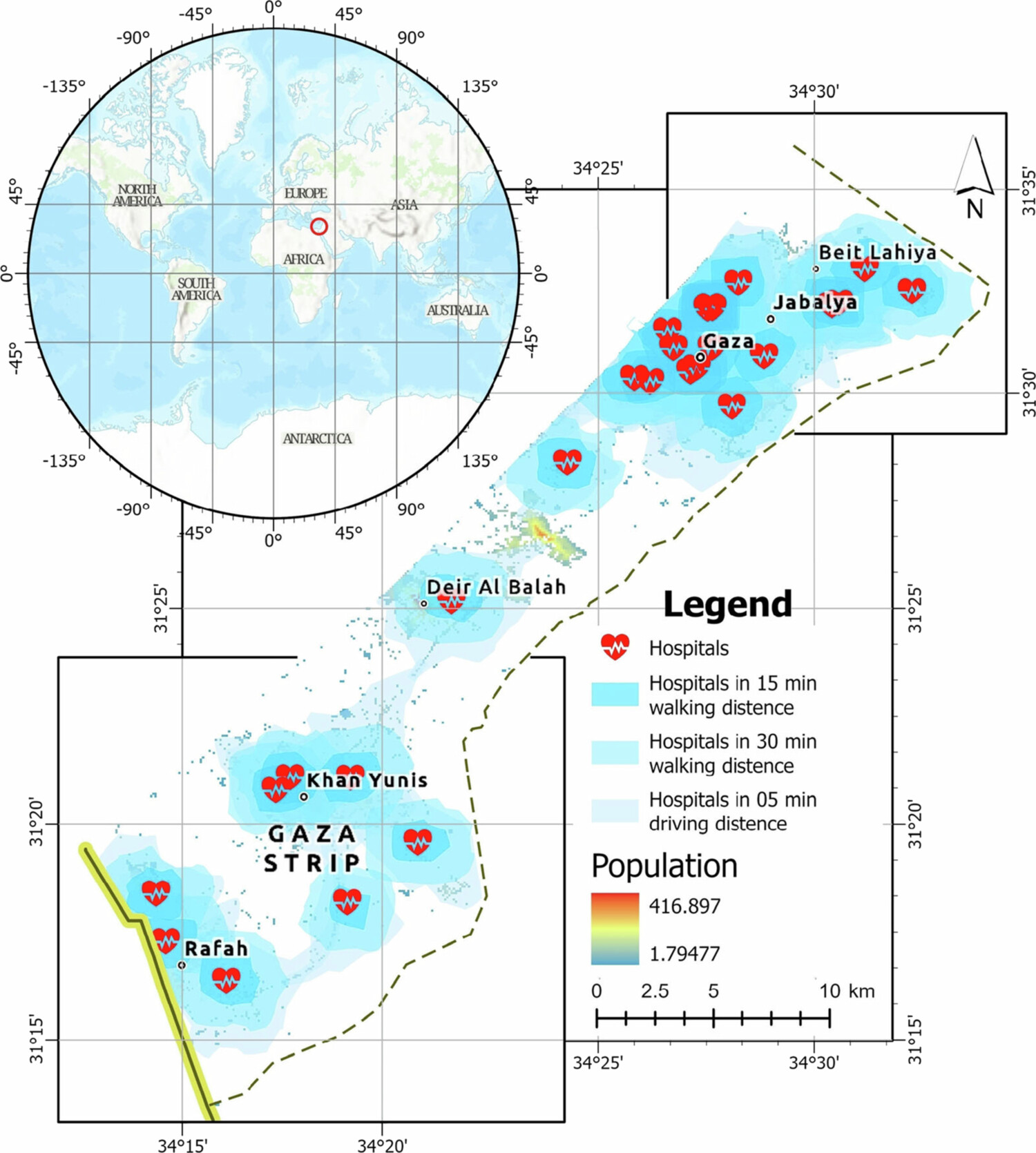
Title: Formal and informal settlements and corresponding demographic patterns in Gaza Strip: deep learning approach to urban sustainability


Title: Formal and informal settlements and corresponding demographic patterns in Gaza Strip: deep learning approach to urban sustainability
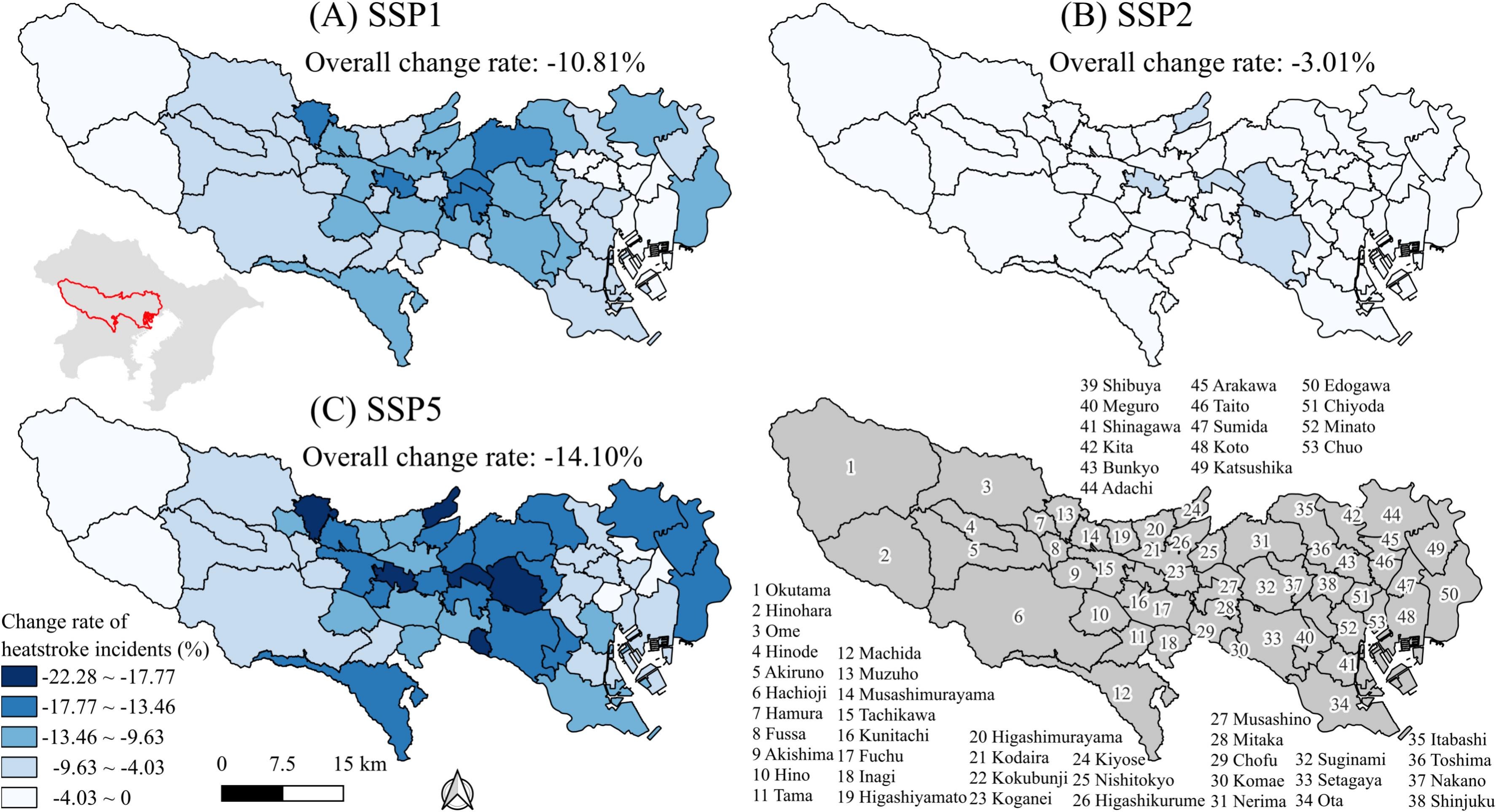
Title: Optimizing urban three-dimensional landscapes in potential development areas to mitigate urban heat island effect under shared socioeconomic pathways
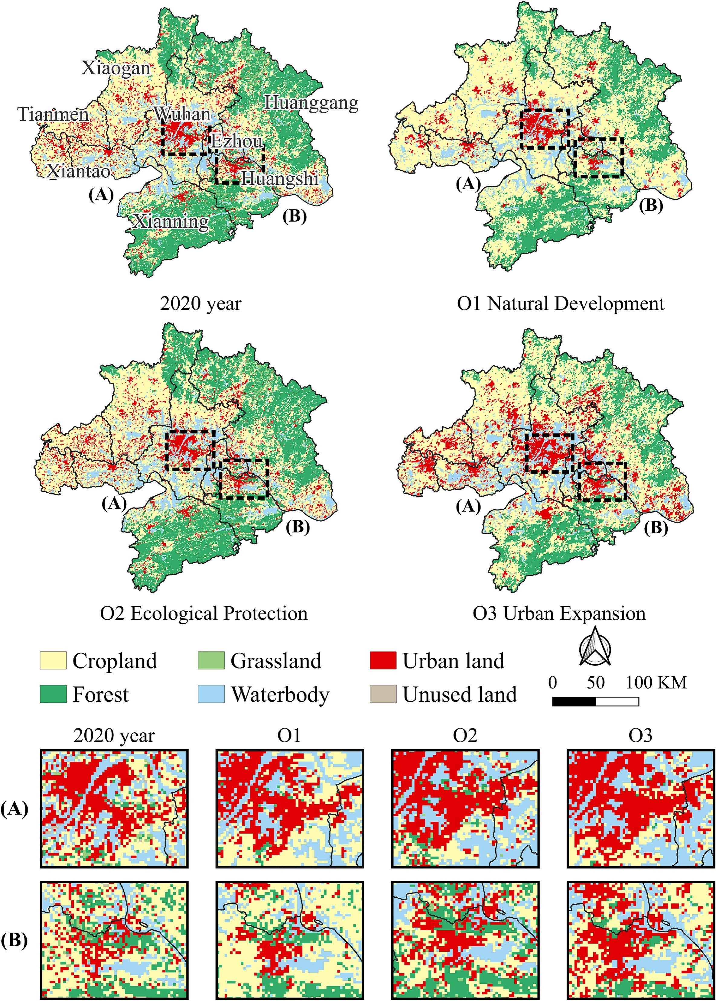
Title: CoCA: Spatial cooperative simulation and future prediction of “land-population-economy” in urban agglomerations

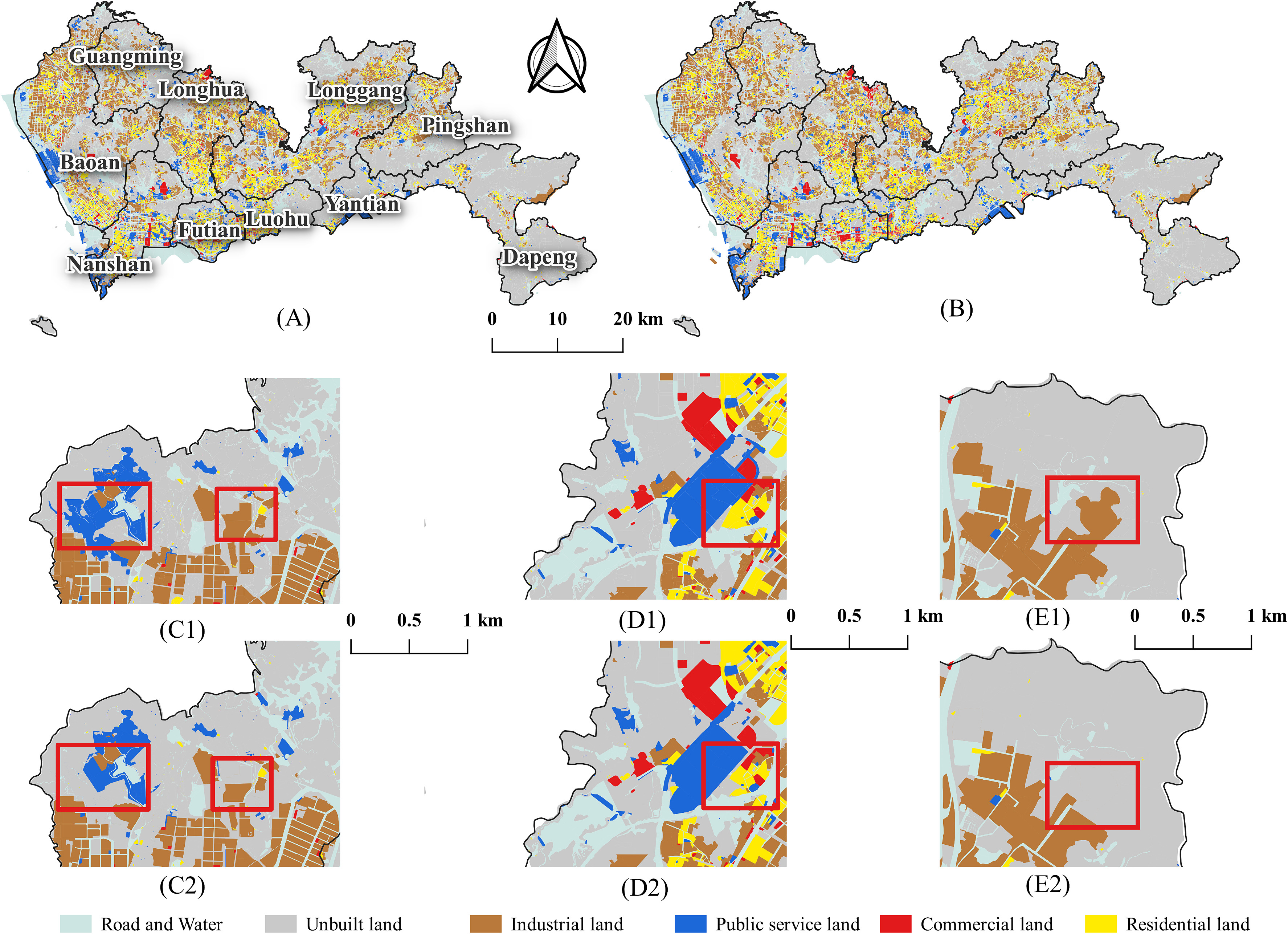
Title: A Framework for Exploring “Transfer-Out” Land Parcels for Urban Development Under the Ecological Control Line (ECL) Policy in China
Title: Temporal-VCA: Simulating urban land use change using coupled temporal data and vector cellular automata
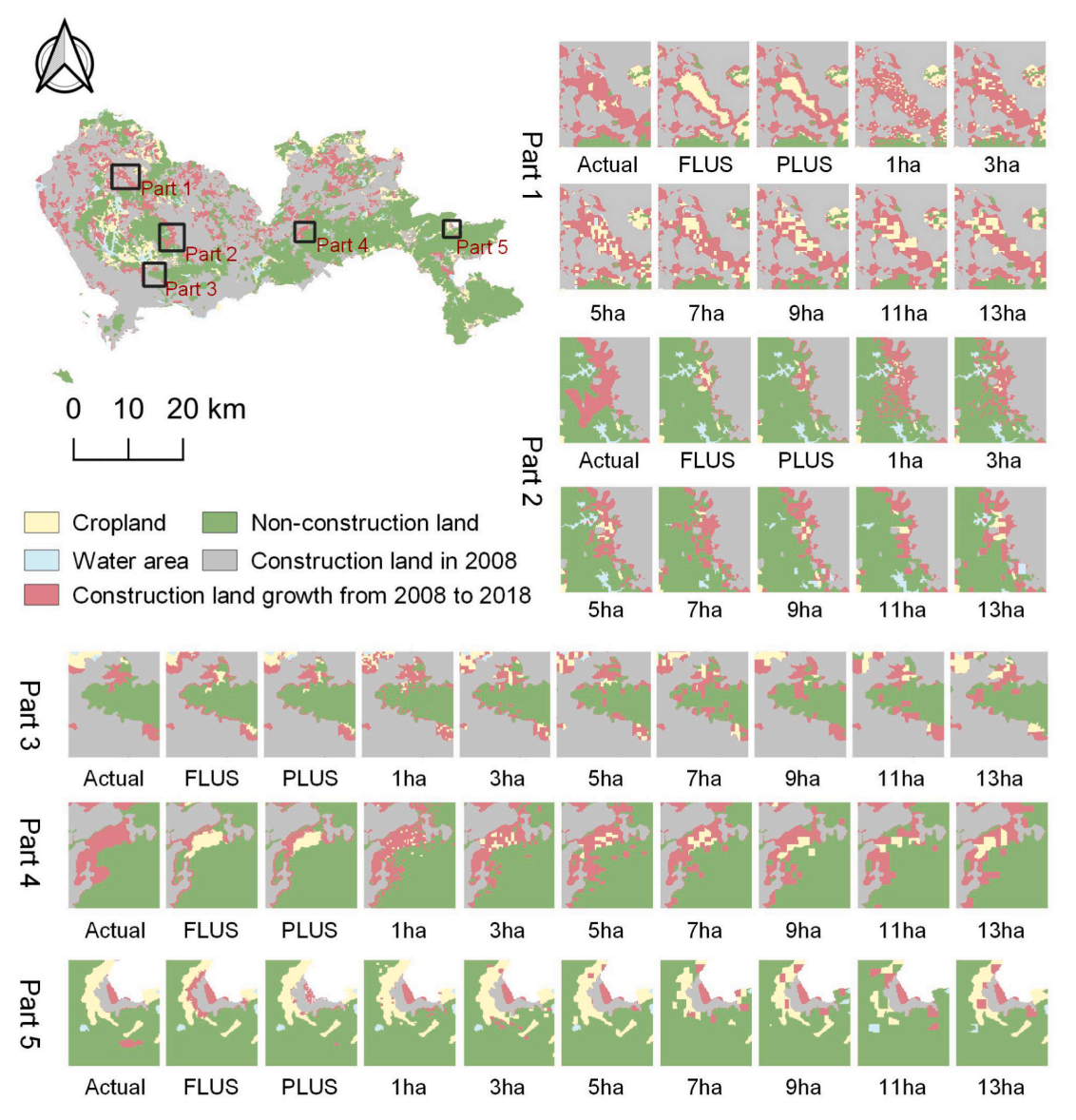
Urbanization-induced land cover changes significantly impact ecological environments and socioeconomic growth. Vector-based cellular automata
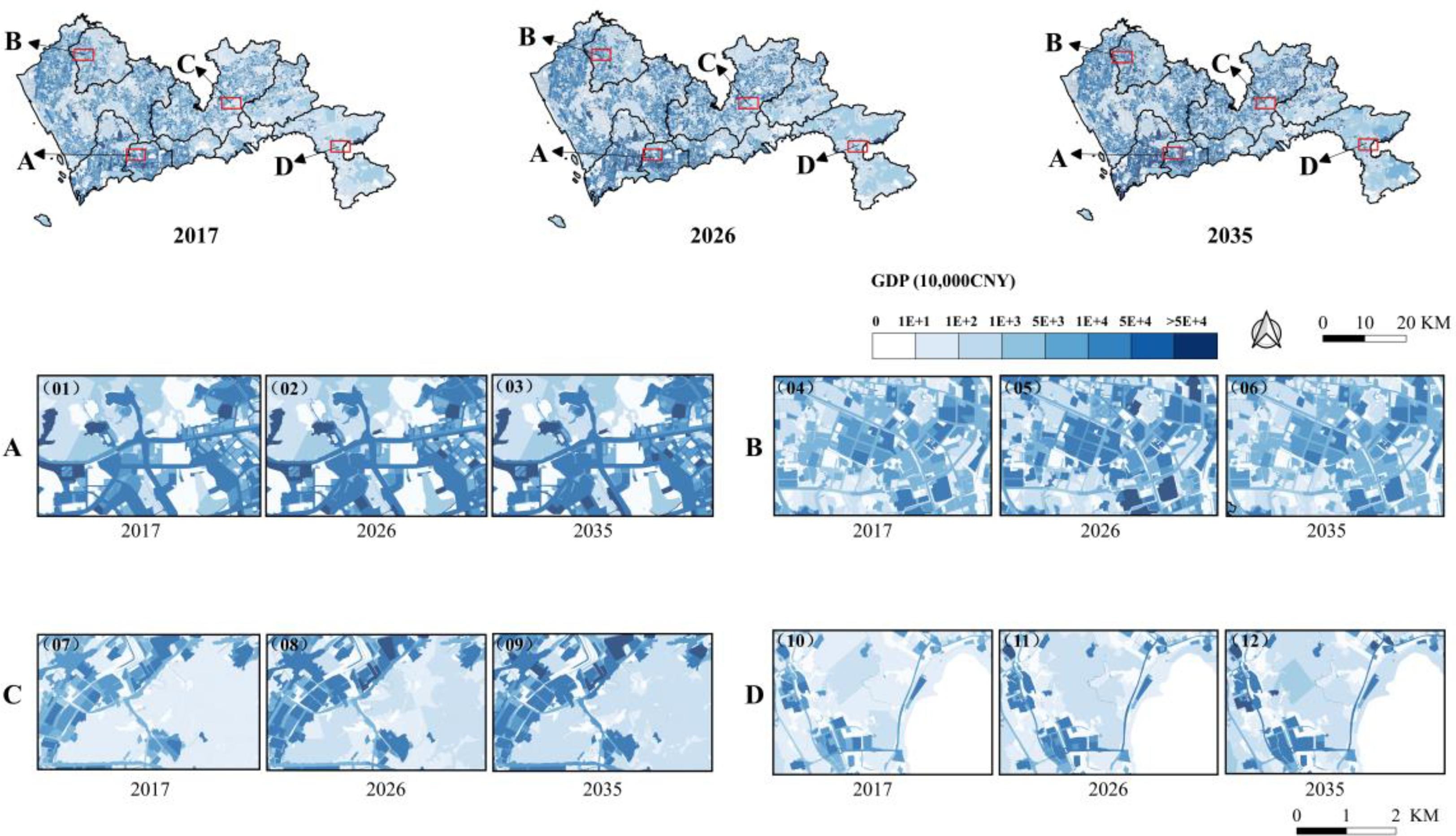
Fine-grained regional economic forecasting for a megacity using vector-based cellular automata

Spatial cooperative simulation of land use-population-economy in the Greater Bay Area, China
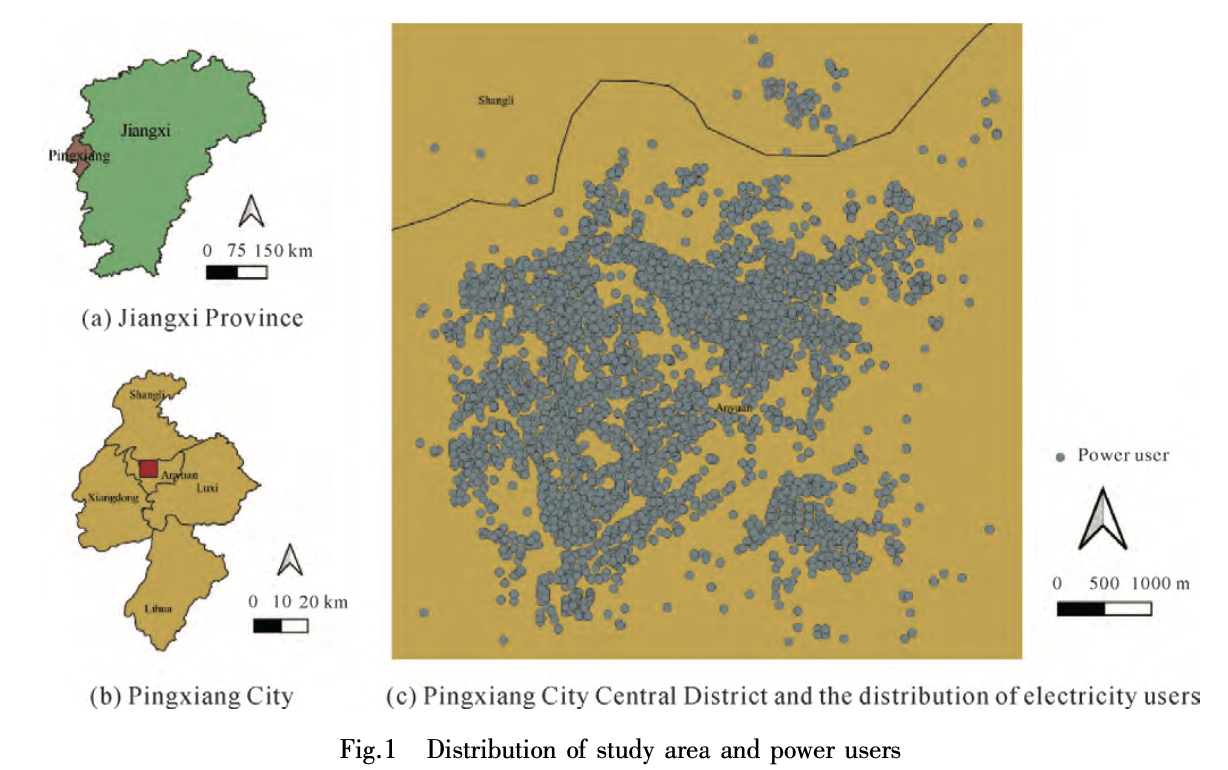
Title:Estimating the spatial variation of electricity consumputionAbstractEffective detection of abnormal electricity users and analysis of the spatia

标题:耦合FLUS和Markov的快速发展城市土地利用空间格局模拟方法Title:A Coupled FLUS and Markov Approach to Simulate the Spatial Pattern of Land Use in Rapidly Developing Cities摘要
UrbanComp
![]()
![]()
![]()