


Highlights
- A new unifying computational framework for vector-based landscape indices is proposed.
- 74.7% of the VecLI metrics are significantly different from the raster-based indices of Fragstats, but 79.3% are strongly correlated.
- A parcel-merging algorithm is proposed to effectively address the impact of landscape fragmentation.
- The open-access VecLI software based on the proposed framework has been developed and released.
Keywords
Vector-based landscape indices; Land parcel fragmentation; Urban environment; Landscape pattern; Fragstats
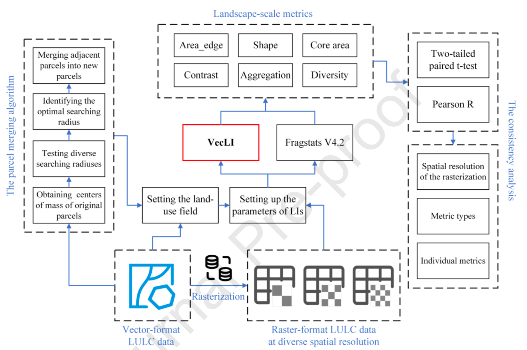
Abstract
Currently, raster-based landscape indices (LIs) that measures the landscape pattern of raster-format land-use data, can be easily computed by relevant software (e.g., Fragstats). Unfortunately, open-access software for vector-based LIs often implement a small variety of metrics, which cannot meet the growing demand of the GIS and landscape design research. The common approach often results in a loss of accuracy. Hence, this paper presents the state-of-the-art VecLI framework for computing 217 vector-based LIs. A parcel merging algorithm is proposed to address the impact of landscape fragmentation on vector-based LIs by considering the neighborhood effect. A case study was conduct in Shunde, China. The result shows that 80% of the LIs from VecLI are strongly correlated to Fragstats's LIs. The patch perimeter-related metrics from VecLI portray a more realistic geographical pattern compared to those from Fragstats. Moreover, the VecLI-based software is developed for use by the GIS and landscape design researchers.
Download
Full-Text Download
Software Download
VecLI v1.0: Click here
VecLI v2.0 (Stable version, Recommended): Click here
VecLI v3.0 beta (Recommended): Click here
Q.E.D.