Abstract
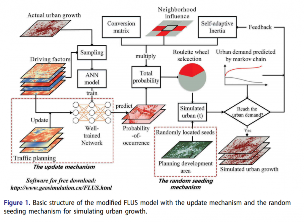
Urban land-use change is affected by urban planning and government decision-making. Previous urban simulation methods focused only on planning constraints that prevent urban growth from developing in specific regions. However, regional planning produces planning policies that drive urban development, such as traffic planning and development zones, which have rarely been considered in previous studies. This study aims to design two mechanisms based on a cellular automata-based future land-use simulation model to integrate different planning drivers into simulations. The first update mechanism considers the influence of traffic planning, while the second mechanism can model the guiding effect of planning development zones. The proposed mechanisms are applied to the Pearl River Delta region, which is one of the fastest growing areas in China. The first mechanism is validated using simulations from 2000-2013 and demonstrates that simulation accuracy is improved by the consideration of traffic planning. In the simulation from 2013-2052, the two mechanisms are implemented and yield more realistic urban spatial patterns. The simulation outcomes can be employed to identify potential urban expansion inside the master plan. The proposed methods can serve as a useful tool that assists planners in their evaluation of urban evolvement under the impact of different planning policies.

Q.E.D.


