


StreetViewRatings Version 1.0是我们HPSCIL团队自主研发的支持人机对抗的图片打分软件(单机版)。
StreetViewRatings Version 1.0 is an image scoring software (Standalone) that supports human-computer adversarial developed by the UrbanComp team at HPSCIL@CUG.
该软件支持的功能 (Special Functions):
1 支持文件夹批量输入图像,用户可以对图片进行快速打分和存储分数;
2 在一定数量图片打分后,程序根据图片特征(外部输入)和用户已有打分,训练机器学习模型预测当前图片的推荐得分;
3 用户在程序界面可看到推荐得分,若误差较大,可对分数进行修改。程序会根据用户修改的幅度通过惩罚机制校正后台模型以逼近用户期待值;
4 支持后台自动存储模型和用户分数,支持中断后重启程序继续打分。程序后台采用最优化的数据结构,支持的数据量理论上无限大,数据查询和记录效率极高。
1 Supporting the images batch input via file folder, users can quickly score and store scores for images.
2 After a certain number of images are scored, the software will train a machine learning model to predict the recommendation score of the current image based on the image features (external input) and the user’s existing score.
3 The user can observe the recommendation score on the program interface and can modify the score if the error is unacceptable. The software will correct the backend model to approximate the user’s expected value through a penalty mechanism based on the user’s modification.
4 This software supports automatic storage of machine-learning model and user scores and supports restarting the program after an interruption to continue scoring. The program’s backend uses the most optimized data structure, supporting a theoretically unlimited amount of data and extremely efficient data querying and recording.
软件下载(Download):
-
直接下载(Click to Download)
点此下载软件(Click Here to Download) -
百度网盘下载(Download from Baidu NetDisk):
https://pan.baidu.com/s/18zqkTLS-FuJYrIkjc2Ne9A
提取码(Password):xph1
软件运行环境(必须) Environment:
Windows 8/10 (64 bit)
Microsoft Visual C++ 2015 Redistributable
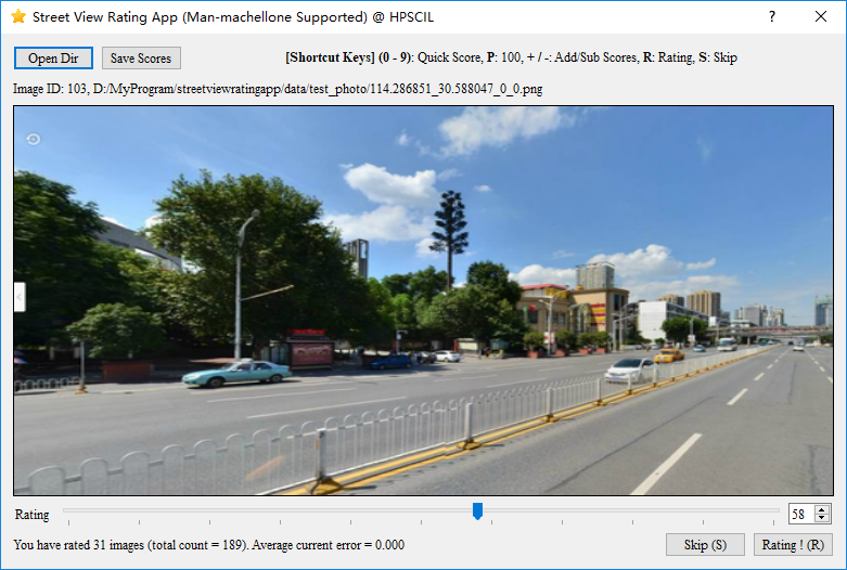
图1 支持人机对抗的图片打分软件界面
Figure 1 UI of the image scoring software
使用方法(Manuals):
1 将图像数据集放入一个文件夹中,通过外部软件(推荐使用我们之前发布的“基于深度学习全卷积网络(FCN)的视觉影像语义分割软件” )将图片张量化形成高维语义特征数据集(或识别图像中地物比例作为特征)。特征文件命名为features.csv,必须放置于图像数据集文件夹中。如图2、图3所示,可以参考软件的.\Data\test_photo文件夹内给出的示例。
注意事项1:feature.csv第一行为图像文件名和特征维数标签(Id_0~Id_xx),文件名和图像文件名一致(不需要扩展名,不需要关心图片排序),特征标签数量和特征维度必须一致,用英文逗号分割(如图3所示)。
注意事项2:如果需要重新对打分新的目标,请清除图像文件夹内自动生成的存储分数文件(命名为auto_save_scores.csv)和模型训练文件(命名为rating_record.rfa)。
1 First, please put the image dataset into a folder, and use an external software (we strongly recommend using our previously released “Deep Learning Full Convolutional Network (FCN)-based Semantic Segmentation software“ ) to quantize the images into a high-dimensional semantic feature dataset (or identify the proportion of features in the image via recommendation FCN-based software). The feature file is named “features.csv” and must be placed in the image dataset folder. As shown in Figure 2 and Figure 3, you can refer to the “. \Data\test_photo” in the software folder.
Note 1: The first row of feature.csv is the image file name and feature dimension labels (Id_0~Id_xx), the file name is the same as the image file name (no extension, no need to care about image file sorting), and the feature labels’ dimension are the same as the feature dimension, split by English commas (as shown in Figure 3).
Note 2: If you need to re-score new targets, please clear the automatically generated stored score file (named “auto_save_scores.csv”) and model training file (named “rating_record.rfa”) in the image folder.
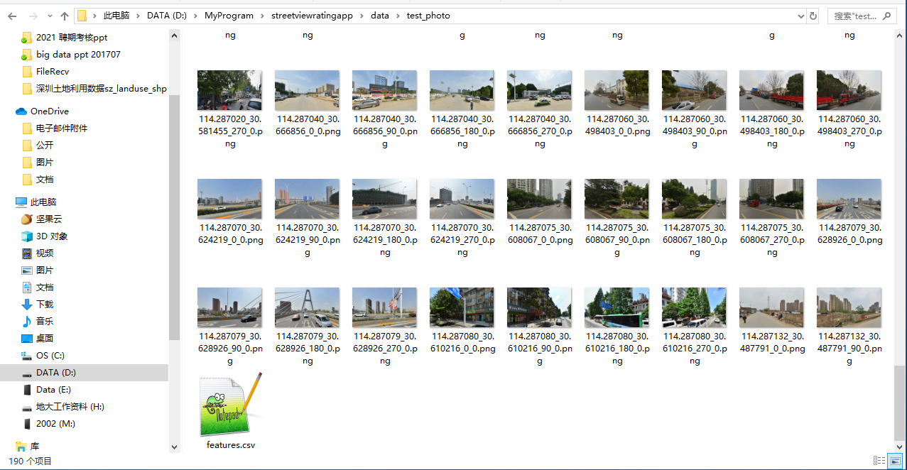
图2 图像数据集文件夹
Figure 2 Image data folder
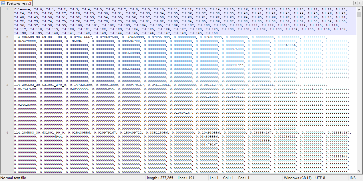
图3 features.csv文件内容
Figure 3 Demo of features.csv
2 启动StreetViewRatingApp,点击Open Dir按钮(图4),打开存储图像数据集的文件夹。程序会自动导入自动存储的图片分数(若存在)和特征文件。如果文件夹内无正确的feature.csv,程序会报错。
2 You can now launch StreetViewRatingApp and click the “Open Dir” button (Figure 4) to open the folder where the image dataset is stored. The program will automatically import the automatically stored image scores (if exist) and feature files. If the folder does not contain the correct “feature.csv”, the program will report an error.
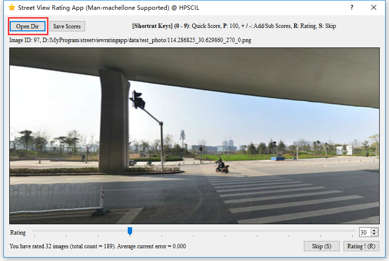
图4 载入图像数据集
Figure 4 Loading image dataset
3 用户通过拖动Rating滚动条对图像进行打分,打分范围为0~100,快捷键如界面(图4)所示。程序会自动存储分数于图像文件夹内(命名为auto_save_scores.csv),训练文件存储于图像文件夹内(命名为rating_record.rfa),如图5所示。
3 The user scores the images by dragging the Rating scroll bar, and the scoring range is 0~100, with the shortcut keys shown on the interface (Figure 4). The program automatically stores the score in the image folder (named “auto_save_scores.csv”) and the training file in the image folder (named “rating_record.rfa”), as shown in Figure 5.
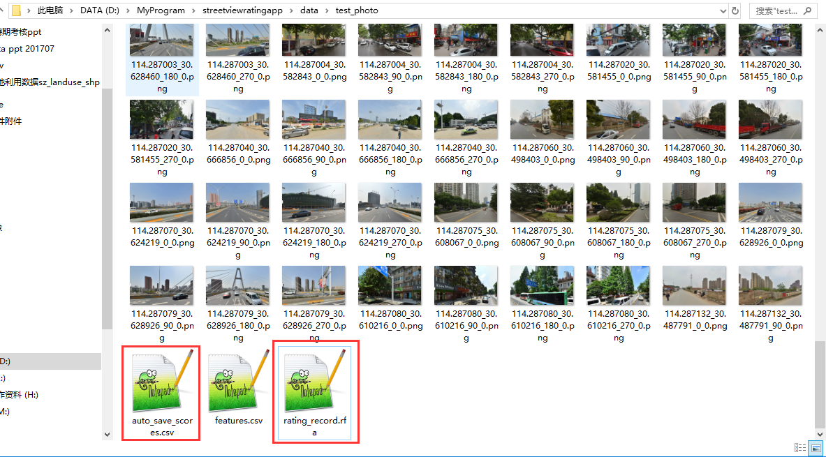
图5 自动生成的存储分数文件(auto_save_scores.csv)和模型训练文件(rating_record.rfa)
Figure 5 Automatically generated stored scores file (auto_save_scores.csv) and model training file (rating_record.rfa)
4 当用户发现分数基本和自己打分一致时,点击程序界面上的Save Scores按钮将分数导出。如果已经打分完毕,记得及时清除图片文件夹内自动生成的存储分数文件和模型训练文件(图5),以防止对下一次新的打分造成干扰。
4 When the user finds that the scores are basically the same as his own, click the “Save Scores” button on the program interface to export the scores into a text file (Figure 6). If you have finished scoring, remember to clear the automatically generated stored score files and model training files in the image folder (Figure 5) in time to prevent interference with the next new scoring.
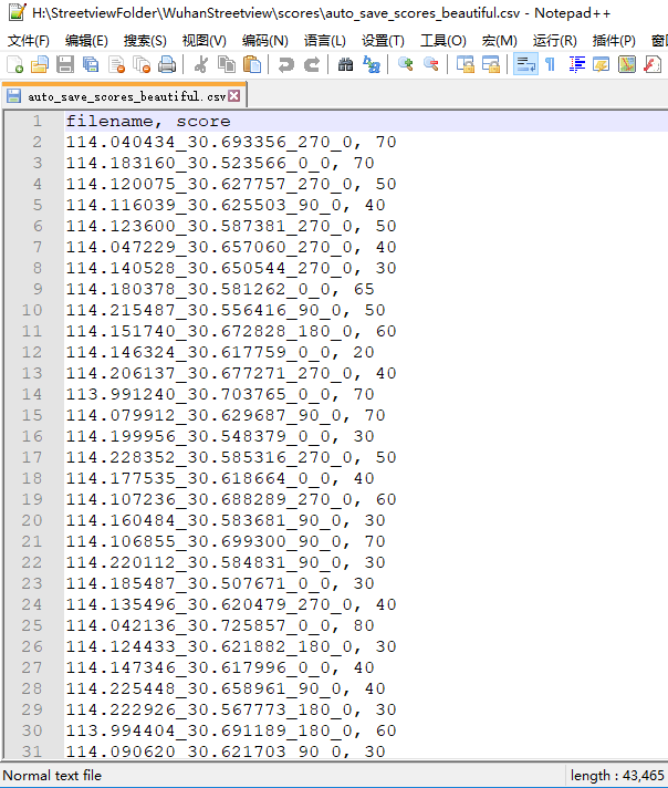
图6 打分结果
Figure 6 Scoring result file
联系方式 (Contact):
该系统的在线版因为服务器故障,暂时无法使用。
If you have any questions, please contact Yao Yao sensei at yaoy@cug.edu.cn.
The online version of this system is temporarily unavailable due to server failure.
参考文献 (Reference):
Yao, Y., Liang, Z., Yuan, Z., Liu, P., Bie, Y., Zhang, J., … & Guan, Q. (2019). A human-machine adversarial scoring framework for urban perception assessment using street-view images. International Journal of Geographical Information Science, 33(12), 2363-2384.
A human-machine adversarial scoring framework for urban perception assessment using street-view images. International Journal of Geographical Information Science
Q.E.D.