


Title: Monkuu: a LLM-powered natural language interface for geospatial databases with dynamic schema mapping
Abstract
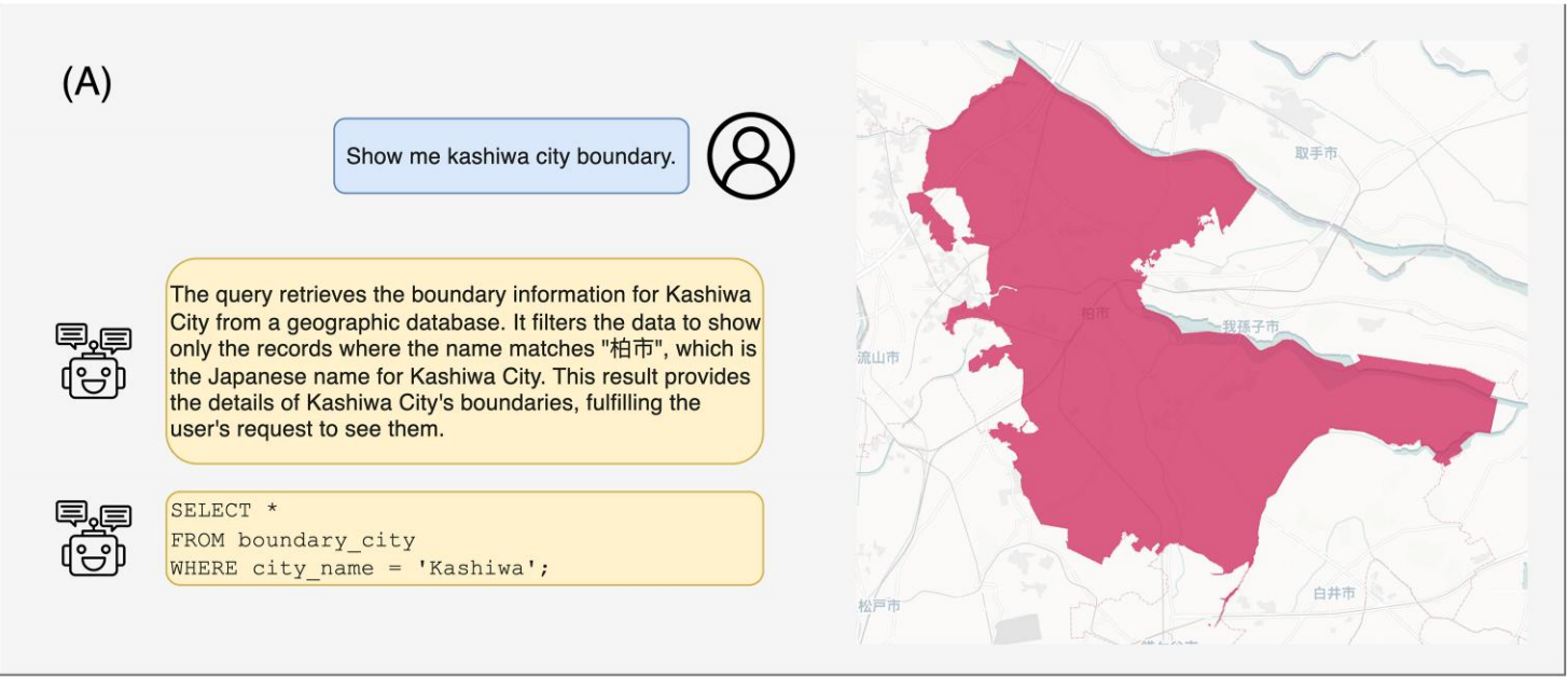
Geospatial databases present significant accessibility challenges due to the complexity of structured query languages. To enable intuitive human-system interactions via natural language, this paper presents Monkuu, a novel natural language-to-SQL interface specifically designed for geospatial databases. Monkuu integrates a dynamic context-aware schema mapping mechanism to align database schemas, effectively overcoming information truncation issues common in traditional Retrieval-Augmented Generation methods. Additionally, a human-in-the-loop geographic disambiguation workflow is introduced to resolve complex place names by combining multi-source geographic data. Monkuu achieves 56.2% execution accuracy on the KaggleDBQA benchmark, improving upon the leading ZeroNL2SQL model by 13.8 percentage points, alongside an 82.4% recall in geographic ambiguity resolution on the GeoQueryJP dataset. The system’s primary contribution lies in its robust database access capabilities with clean data interfaces for downstream spatial analysis tools while maintaining focus on accurate query translation. Case studies demonstrate its effectiveness in processing queries like ‘Show me the boundary of Kashiwa’ into executable SQL, significantly lowering technical barriers for non-expert users. This work advances equitable and accessible geographic information services.
Highlight
- Converts natural language to geospatial SQL via dynamic schema mapping.
- 56.2% accuracy on KaggleDBQA (+13.8% over ZeroNL2SQL)
- Hybrid disambiguation boosts location resolution accuracy to 82.4% on GeoQueryJP.
- Introduces Schema Mapper for enhanced SQL query generation accuracy.
- Modular design enables downstream spatial tool integration.
Keywords
Large language model
database interface
schema mapping
nl2sql
geospatial entity disambiguation
Full Text Download
International Journal of Geographical Information Science
Q.E.D.