Title: Unsupervised land-use change detection using multi-temporal POI embedding
Abstract
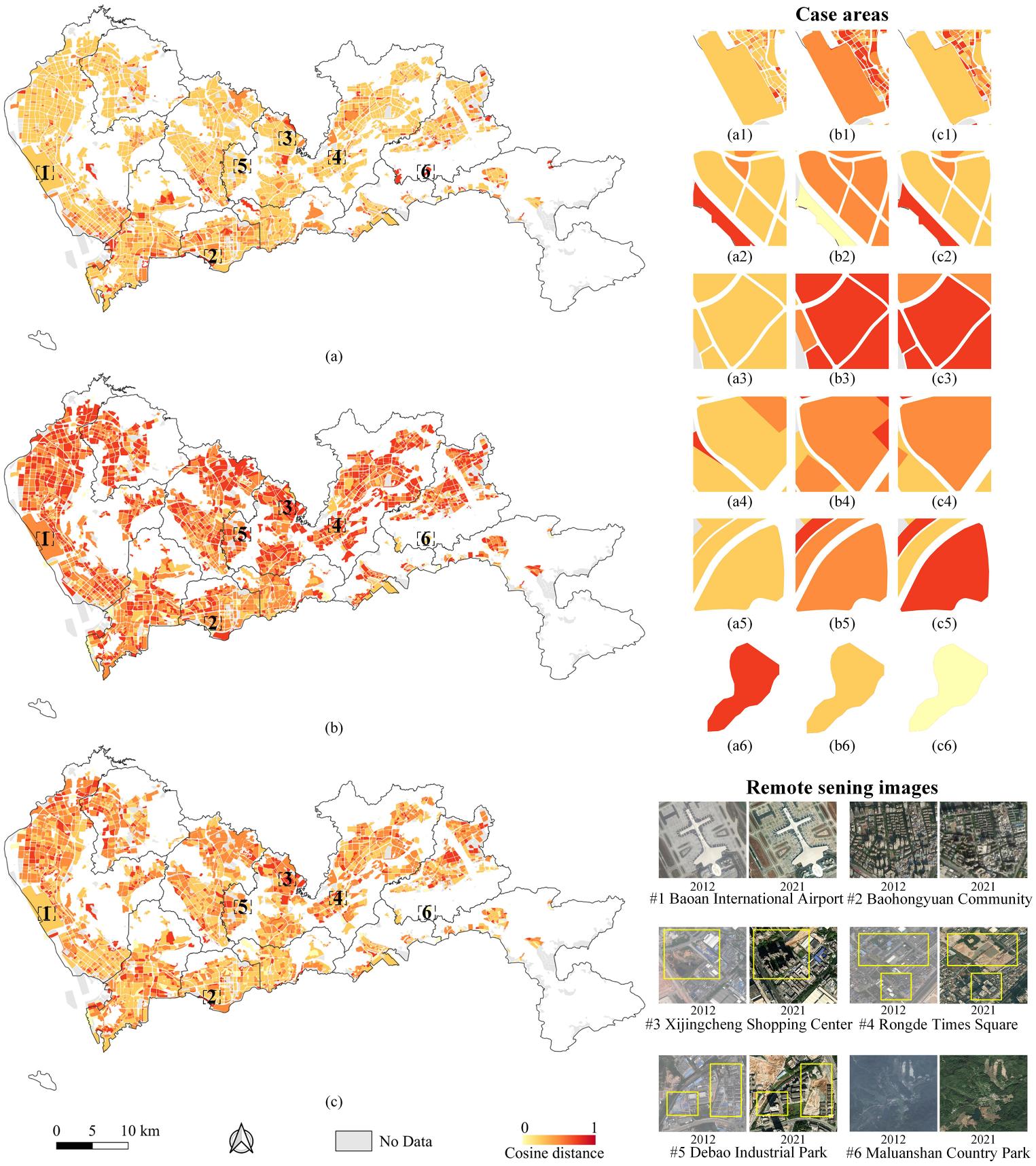
Rapid land-use change detection(LUCD) is pivotal for refined urban planning and management. In this paper, we investigate LUCD through learning embeddings of points of interest(POIs) from multiple temporalities. There are several prominent challenges: (1) the co-occurrence problem of multi-temporal POIs, (2) the heterogeneity of POI categorization, and (3) The lack of human-crafted labels. Therefore, multi-temporal POIs need to be aligned in the embedding space for effective LUCD. This study proposes a multi-temporal POI embedding(MT-POI2Vec) technique for LUCD in a fully unsupervised manner. In MT-POI2Vec, we first utilize random walks in POI networks to capture their single-period co-occurrence patterns; then, we leverage manifold learning to capture (1) single-period categorical semantics of POIs to enforce semantically similar POI embedding to be close and (2) cross-period categorical semantics to align multi-temporal POI embedding in a unified embedding space. We conducted experiments in Shenzhen, China, which demonstrates that the proposed method is effective. Compared with several baseline models, MT-POI2Vec can better align multi-temporal POIs and thus achieve higher performance in LUCD. In addition, our model can effectively identify areas with unchanged land use and land use changes in residential and industrial areas at a fine scale.
Keywords
Land-use change;
embedding space alignment;
points of interest;
POI embedding
Full Text Download
International Journal of Geographical Information Science
Q.E.D.