








题目:面向国土空间规划实施评估的双路径土地利用变化模拟方法
Title: A dual-path land use change simulation method for territorial spatial planning implementation evaluation
摘要 (Abstract)
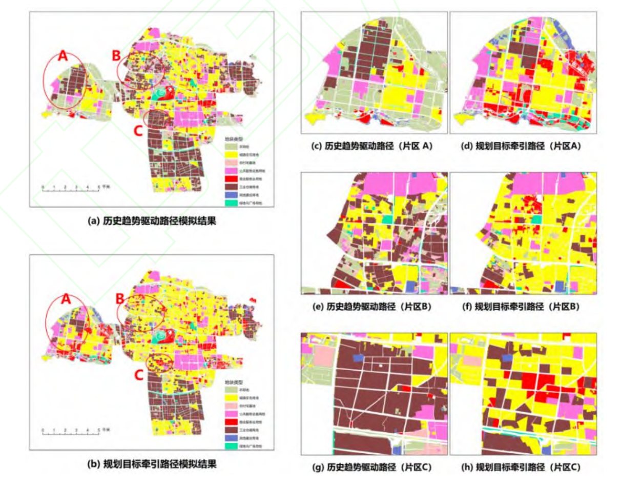
规划实施评估和重点区域调控是国土空间规划进入实施管理阶段后的重要需求。现有土地利用变化模拟多侧重单一路径下的格局预测,难以在统一条件下辨析历史惯性与规划目标导向的差异。为此,提出一种融合历史变化基线与规划目标导向的双路径土地利用变化模拟方法。基于 2019—2024 年土地利用、空间驱动与约束及 2035 年国土空间规划数据,采用马尔可夫链模型与矢量元胞自动机模型构建历史趋势驱动路径;以现状与规划目标的差额为数量约束,构建规划目标牵引路径;进而对双路径结果进行数量结构、空间配置和规划偏离对比与叠置诊断。以常州市武进区中心城区为研究区,结果表明:模型回测中,数量预测的 L1 精度为 0.98,空间模拟的总体精度、Kappa 系数和优值因子分别为 0.92、0.90 和 0.26;双路径差异主要集中于农用地、城镇住宅用地、工业仓储用地和商业服务业用地,并在外围发展区、既有开发区及工业连续带边缘集聚;双路径协调区、历史惯性偏离区、规划实施难点区和规划调整不稳定区分别占研究区的 48.21%、18.90%、27.12%和 5.77%。
Evaluating the implementation of territorial spatial planning is essential for dynamic monitoring, identifying spatial deviations, and supporting differentiated regulation. Existing land-use change simulations generally focus on pattern prediction along a single path, while planning constraints are often treated merely as external restrictions. Consequently, these simulations have limited capacity to distinguish the effects of historical inertia from those of planning guidance under comparable conditions or to translate simulation outputs into implementation-oriented spatial diagnoses. This study develops a dual-path land-use change simulation framework to identify differences between historical trends and planning targets and diagnose potential implementation deviations.[Methods] The central urban area of Wujin District, Changzhou, China, was selected as the study area. Land-use data from 2019 to 2024, spatial drivers and constraints, and the 2035 territorial spatial plan were integrated. Under a common baseline, land-use classification system, conversion rules, and spatial constraints, a Markov chain model was used to project land-use demand for the historical trend-driven path, and a vector-based cellular automata (VCA) model allocated the projected demand at the parcel level. For the planning target-driven path, differences between the 2024 land-use structure and the 2035 planning targets were used as quantity constraints, while planning targets, spatial constraints, and conversion rules were incorporated into the VCA model. The outputs of the two paths were compared in terms of quantity structure and spatial configuration and were overlaid with the 2035 planning targets to identify areas of dual-path coordination, historical inertia deviation, planning implementation difficulty, and planning adjustment instability. Back-testing used land-use observations from 2019 to 2023 as inputs and 2024 land use as the reference.[Result] In the back-test, the quantity projection achieved an L1 accuracy of 0.98, a mean absolute error of 23.53 hm2, and a root mean square error of 31.86 hm2,. The spatial simulation achieved an overall accuracy of 0.92, a Kappa coefficient of 0.90, and a Figure of Merit (FoM) of 0.26. Under the historical trend-driven path, the calculated deviations of agricultural land and urban residential land relative to the planning targets were 50.84% and −75.57%, respectively; under the planning target-driven path, the corresponding values narrowed to 0.89% and −1.03%. Differences between the two paths were concentrated in agricultural land, urban residential land, industrial and warehousing land, and commercial and business service land, particularly in peripheral development areas, existing built-up areas, and industrial-belt margins. The four diagnostic categories—dual-path coordination, historical inertia deviation, planning implementation difficulty, and planning adjustment instability—accounted for 48.21%, 18.90%, 27.12%, and 5.77% of the study area, respectively.[Conclusion] The comparison indicates that deviations from the 2035 planning targets are spatially heterogeneous: some are attributable mainly to the continuation of historical land-use trends, whereas others persist even under planning-target constraints. The four-zone diagnosis helps distinguish areas with different levels of implementation difficulty and monitoring priority.
关键词 (Key Words)
规划实施评估;
土地利用变化模拟;
双路径模拟;
规划偏离分析
planning implementation evaluation;
land-use change simulation;
dual-path simulation;
planning deviation analysis
原文链接 (Full Text)
时空信息学报 (Journal of Spatio-temporal Information)
(https://onlinelibrary.wiley.com/doi/10.1111/tgis.70388)
Q.E.D.