


Abstract
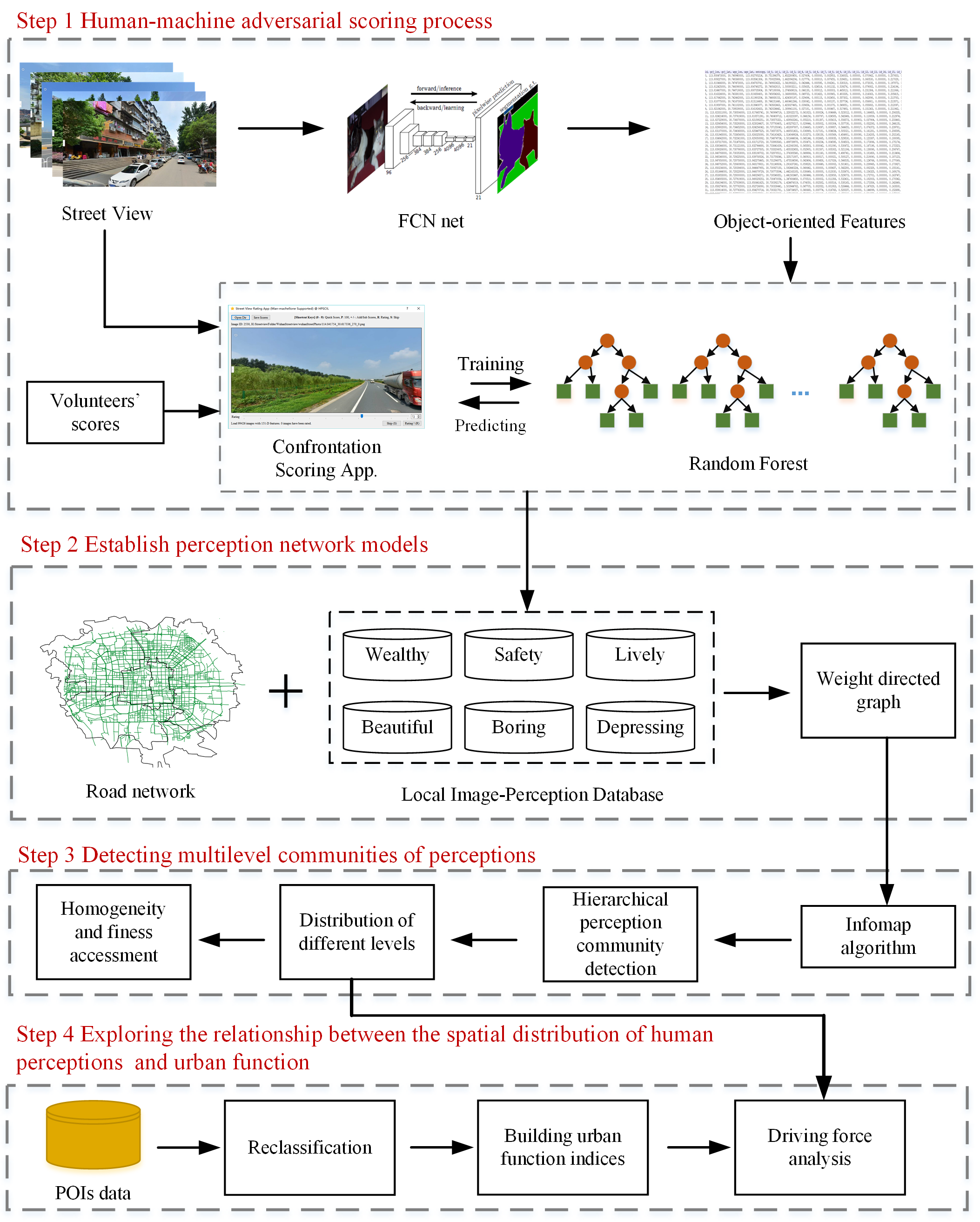
Human perception of place refers to residents’ psychological feelings about urban areas. Many studies of human perceptions have focused on a specific geographic location. Whether the distribution of human perceptions in continuous city space shows specific characteristics and how to disclose these phenomena remains a direction worth exploring. Due to cities’ heterogeneity, quantitatively identifying the homogeneous perception regions at a fine scale within large urban regions is challenging. This study proposed a novel method to discover the homogeneous geographic domain of human perception using massive street view images. First, human perceptions of the urban visual environment were evaluated using street view images. Next, perception network models were constructed based on the road network and perception assessment results. Then, the Infomap community detection algorithm was used to identify homogeneous human perception communities. The qualitative and quantitative results verified our approach’s effectiveness for capturing human perceptions’ homogeneous geographic domain. Moreover, driving factor analysis was conducted to determine the urban function that may cause a community to be perceived differently based on point-of-interest (POI) data. In general, our method for combining human perceptions and the topology of urban roads could identify the homogeneous perception domain, which is valuable for urban structure studies and human perception assessment.
Q.E.D.