ABSTRAT
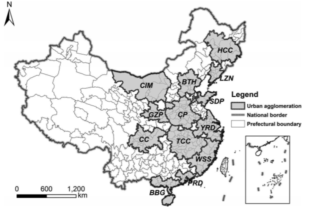
Intercity transportation infrastructures and services determine the depth and breadth of the spatial interactions among cities within an urban agglomeration, and have profound impacts on the spatial structure of the urban agglomeration. To evaluate whether the public intercity ground transportation infrastructures and services (i.e. passenger trains and long-distance buses) can support the integration and development of urban agglomerations, we propose a method for ‘transportation cluster’ detection (TCD), which has three unique features: (1) the K-shortest paths are used to quantify the proximity between cities, which is more in line with people’s travel behaviors; (2) a dendrogram is obtained through hierarchical clustering to reveal the structural hierarchies of transportation clusters; and (3) the integration of geo-modularity and hierarchical clustering assures high strength of division of transportation networks. The proposed TCD method was applied to the network of passenger trains, the network of long-distance buses, and the combined network of both in mainland China, respectively. By comparing the resultant transportation clusters with the urban agglomerations delineated by the Chinese government, cities that have weak transportation connections with other cities within an urban agglomeration were identified, and such findings could help devise transportation planning to better support the integrated development of urban agglomerations.

Q.E.D.


