cuFSDAF: An Enhanced Flexible Spatiotemporal Data Fusion Algorithm Parallelized Using GPU
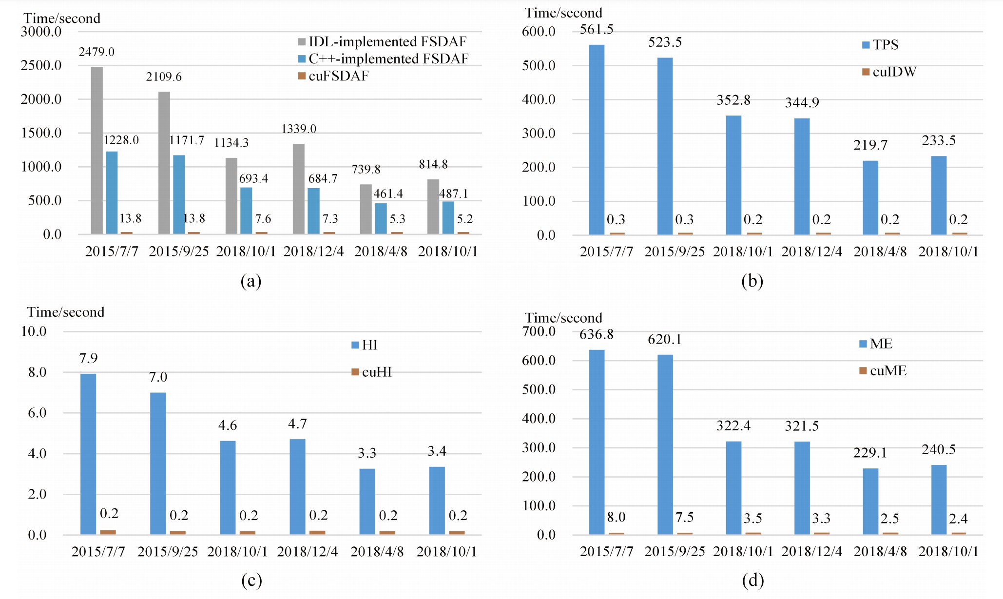
AbstractSpatiotemporal data fusion is a cost-effective way to produce remote sensing images with high spatial and temporal resolutions using multisour


AbstractSpatiotemporal data fusion is a cost-effective way to produce remote sensing images with high spatial and temporal resolutions using multisour
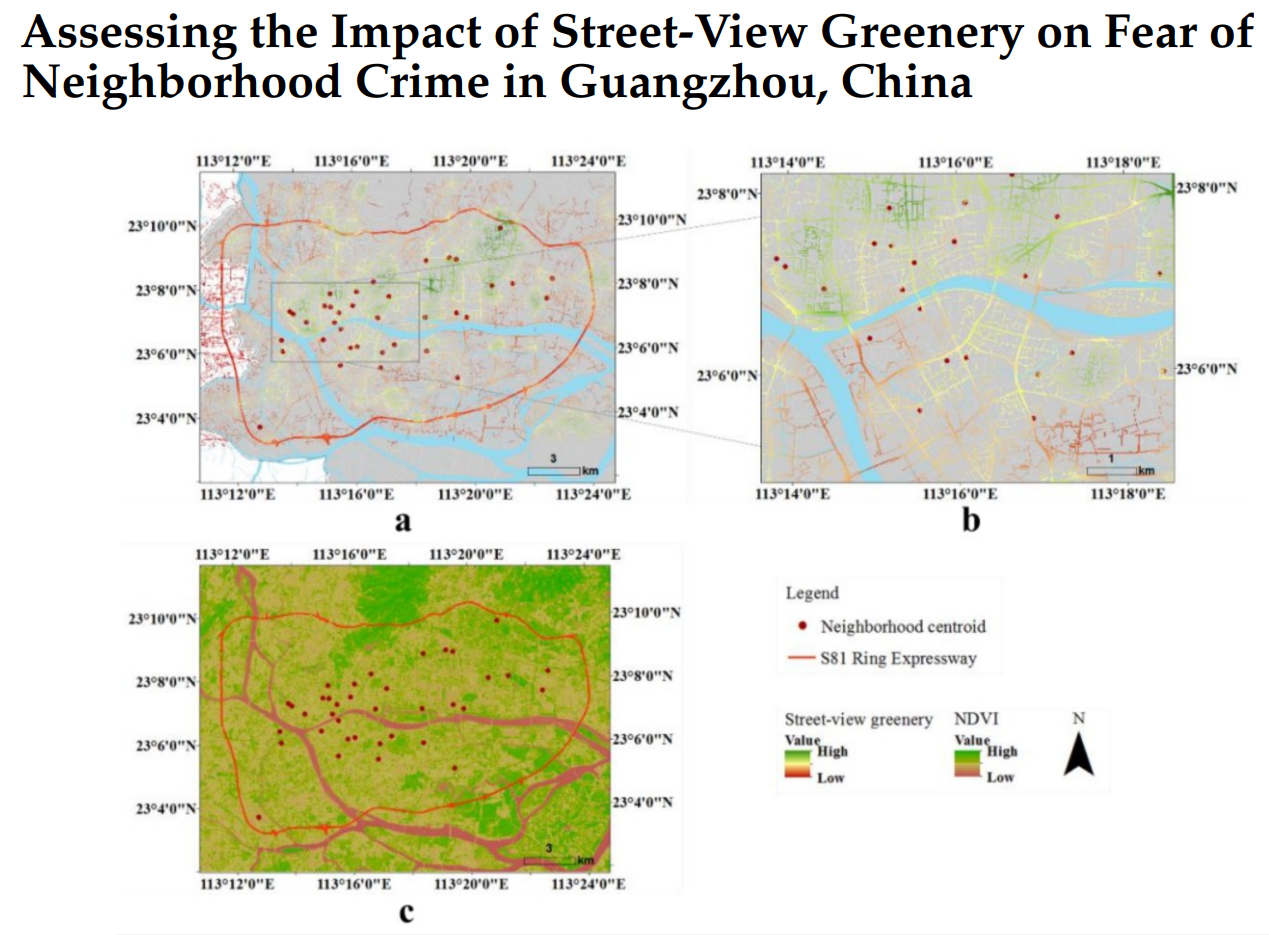
AbstractHuman perception of place refers to residents’ psychological feelings about urban areas. Many studies of human perceptions have focused on a s

AbstractEmpirical data are limited to decipher where people live and work in large cities; however, neighborhood information, such as street view imag
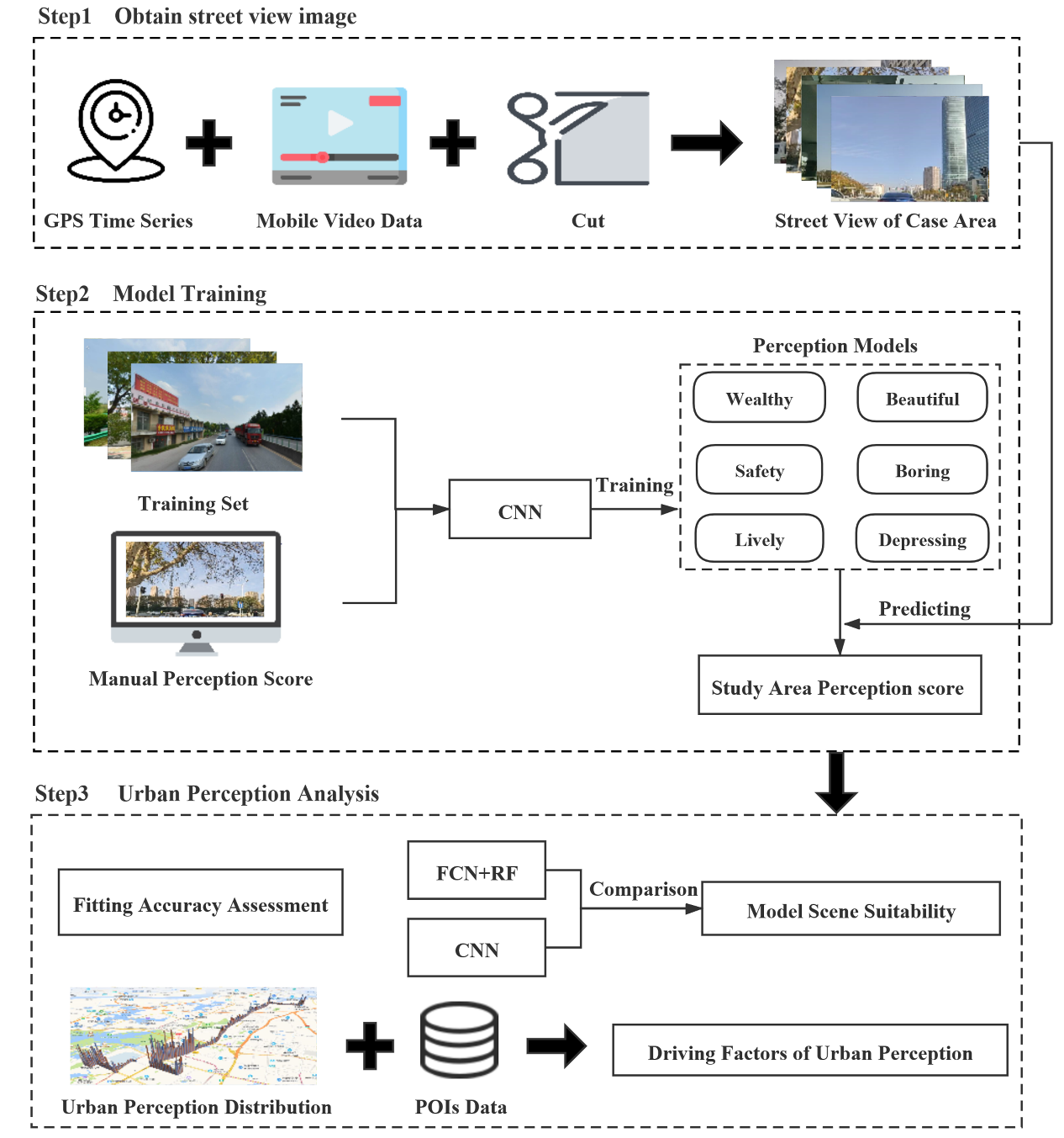
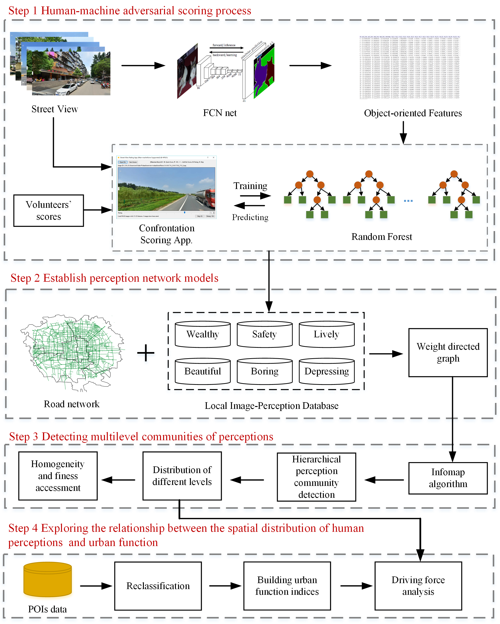
AbstractUrban perception is a hot topic in current urban study and plays a positive role in urban planning and design. At present, there are two metho
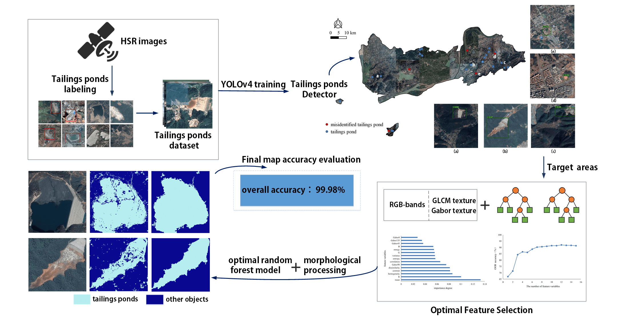
AbstractDue to a lack of data and practical models, few studies have extracted tailings pond margins in large areas. In addition, there is no public d
摘要针对高分辨率遥感影像中地物的复杂性和多变性带来的地物提取难点,提出了一种基于多层次规则的面向对象的典型地物提取方法。改进了基于区域增长的影像分割方法,利用小区域内的全局最优策略进行初始增长,避开了种子点的选择。利用影像分割得到的影像对象作为地物提取的基元,针对影像上典型地物选择提取特征 ,利用多
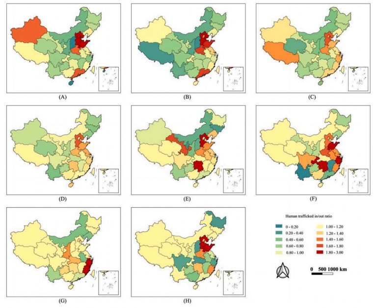
AbstractIn China, the illegal adoption of missing persons and especially of missing children is a major public safety issue that affects social and fa
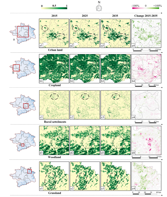
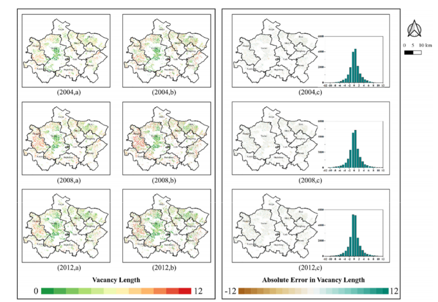
AbstractWhen used for land use change modeling, Cellular Automata (CA) usually assume that each cell has only one land use type at each time step, ign
AbstractThe biased population coverage and short temporal lengths of newly emerged data sets (e.g., data sets of social media, mobile phones, and smar
Augmented Reality (AR) for geographic data is an important development direction of geographic information visualization. In recent years, some geogra
UrbanComp
![]()
![]()
![]()