The Traj2Vec Model to Quantify Spatial Trajectories and Estimate Urban Land Use Types
The formulation of mixed urban land uses is not only intended to find the ideal scenario of land use but also regarded as a way toward sust


The formulation of mixed urban land uses is not only intended to find the ideal scenario of land use but also regarded as a way toward sust
ABSTRACTVector-based cellular automata (VCA) models have been applied in land use change simulations at fine scales. However, the neighborhood effects
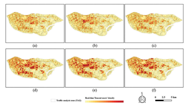
AbstractThe spatial distribution characteristics and activity patterns of urban populations play essential roles in studies of spatial isolation, opti
ABSTRATThe significance of urban function recognition has stimulated the need for multi-source geospatial data fusion, especially the fusion between r
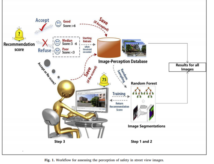
ABSTRATThough global-coverage urban perception datasets have been recently created using machine learning, their efficacy in accurately assessing loca
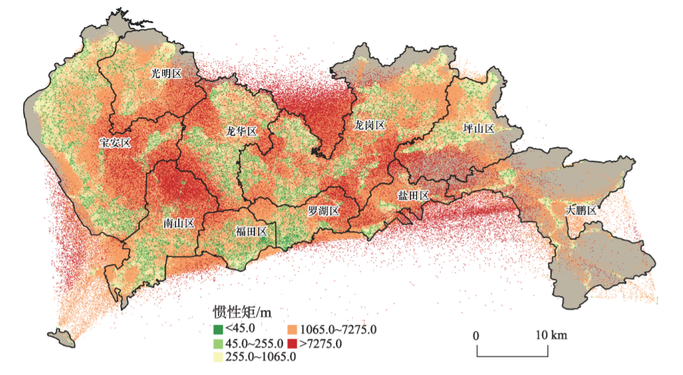
ABSTRAT地理时空大数据被广泛用于城市功能结构识别,其中功能层次性的研究对于系统理解城市功能的结构特征和分布形态具有重大意义,但相关研究仍处于空缺状态。 基于时序出租车出行数据和感兴趣点数据描述居民出行模式,结合动态时间规整和K-MEDOIDS聚类算法识别城市的功能属性和空间结构。 研究结果表明
ABSTRATChina’s rapid urbanization has caused a large number of migrants to move to the city, which has also led to housing shortages. Rapid access to
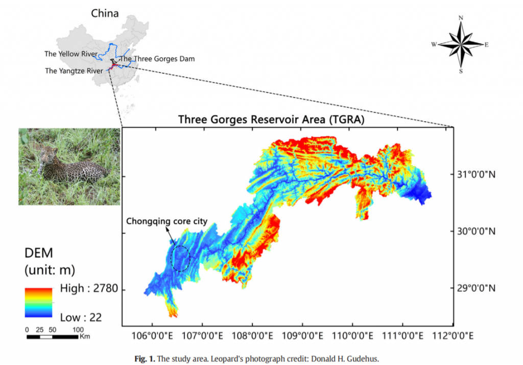
AbstractUnderstanding the impact of urban expansion on functional connectivity is significant to biodiversity conservation. Particularly, in the Three
_1628066373433.png)
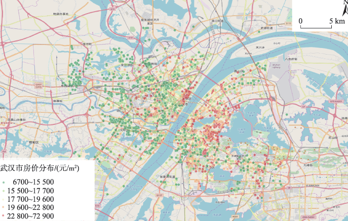
AbstractThe accurate mapping of urban housing prices at a fine scale is essential to policymaking and urban studies, such as adjusting economic factor
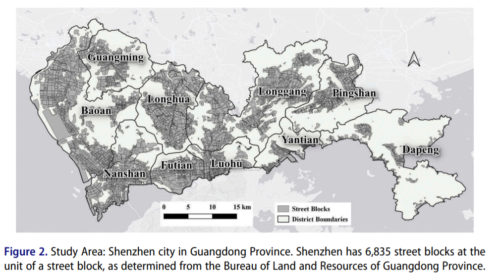
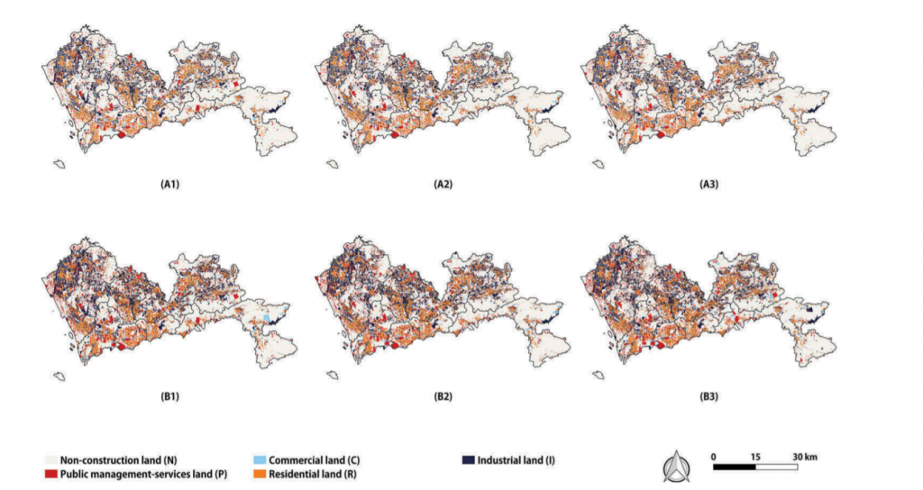
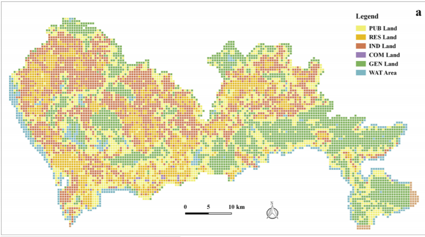
AbstractUrban land use information plays an important role in urban management, government policy-making, and population activity monitoring. However,
UrbanComp
![]()
![]()
![]()